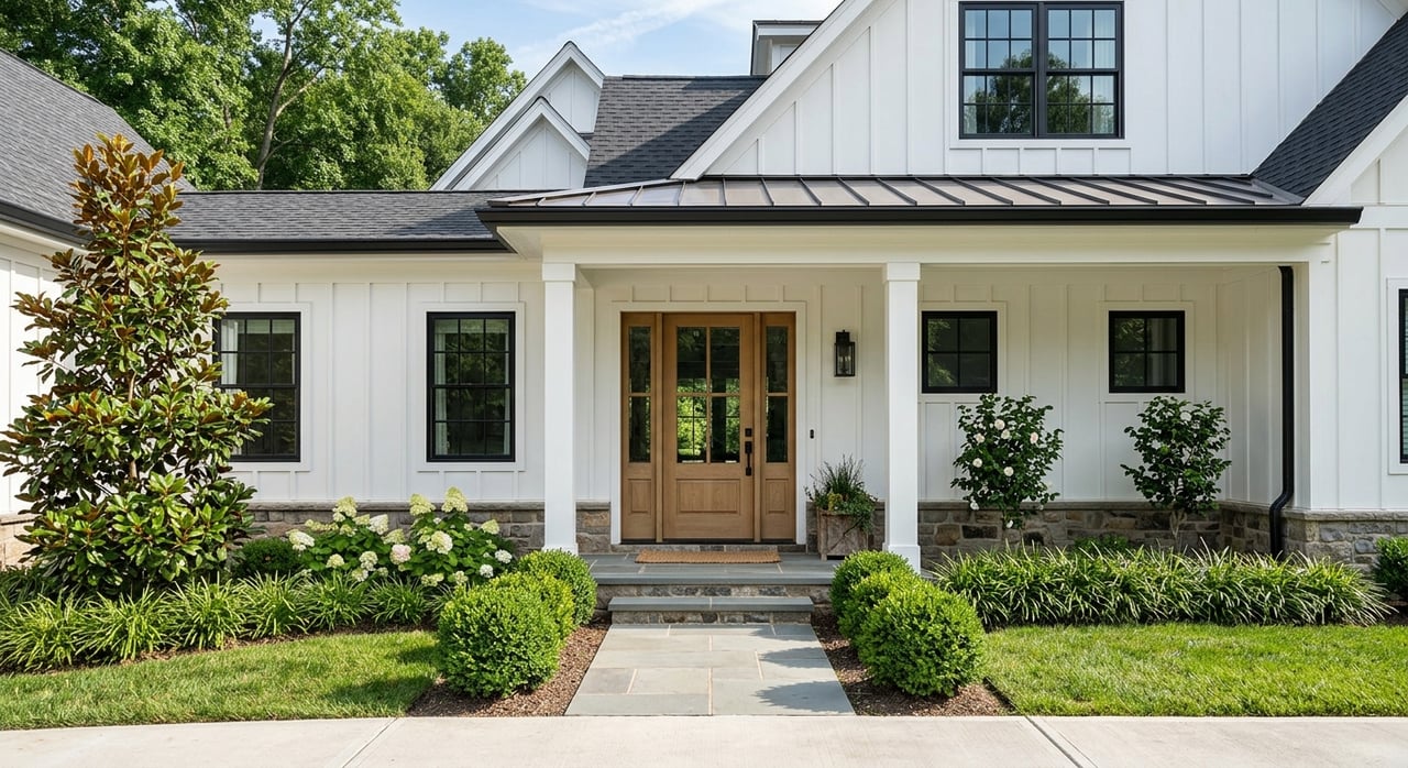
If you love the idea of a boat in your backyard, Lake Norman makes it easy to picture the lifestyle. The detail many buyers overlook is how changing lake levels affect daily life at the dock, from launching your boat to the way your shoreline looks in winter. If you are shopping or owning in 28037 around Denver and Lincoln County, understanding these shifts will help you choose smarter and enjoy the lake more. In this guide, you will learn what drives Lake Norman’s levels, how coves differ from the main channel, what to look for in docks and lifts, and where to find reliable, real-time updates. Let’s dive in.
Who manages the water
Lake Norman is part of the Catawba River system and is managed by Duke Energy for hydroelectric operations and system-wide water management. Levels change for several reasons, including power generation, flood-control storage, scheduled maintenance, and rainfall or runoff. That means day-to-day shifts are normal, and larger seasonal changes are planned.
For the most current information, rely on official sources. You can find operating notices and shoreline rules on Duke Energy’s lake levels and shoreline management pages. For real-time water data across North Carolina, the USGS water data site is another helpful reference. These resources are the first places you should check before planning dock work or major boating activities.
Seasonal patterns to expect
Lake levels typically follow a seasonal rhythm, with some local nuance in 28037:
- Late spring to early summer: Levels often trend higher to support recreation, although planned maintenance can create temporary dips.
- Summer: Levels are usually near recreational targets, but short-term fluctuations can happen due to storms and power generation.
- Fall and winter: Operators may lower the lake moderately to create more flood storage and schedule maintenance. Expect more visible shoreline and shallower water in smaller coves.
- After major rain: Levels can rise quickly. Conversely, extended drought can lead to lower-than-normal conditions.
In Lincoln County, small coves and shallow shoreline points are more sensitive to drawdowns. At lower water, you may see exposed mud flats or stumps, and some cove approaches can become tricky to navigate. The main channel generally remains deeper and more consistent, which matters if you keep a larger boat or want year-round navigation.
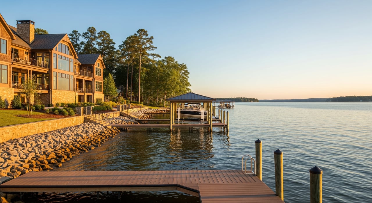
Docks that work with the water
The dock you choose has a big impact on how usable your waterfront is when levels change. Here is how common options perform:
- Floating docks: These rise and fall with the lake and usually maintain access as levels change. They work well in coves, but you need a gangway long enough to handle seasonal swings and a secure shore attachment.
- Fixed (pile) docks: These stay at a fixed elevation relative to land. They can feel sturdy and support heavier structures, but they rely on having enough water depth at low levels. In a shallow cove or during winter drawdowns, a fixed dock can become difficult to use.
- Covered slips and boathouses: These typically need deeper, consistently navigable water, which is why you often see them near the main channel or in deeper coves. Design and placement are more tightly regulated.
- Shoreline protection: Seawalls and riprap help stabilize banks but do not change depth. In lower water, natural foreshore can become visible, which affects aesthetics.
Boat lifts should be installed with level changes in mind. They need to be high enough to avoid damage during high inflow or bigger waves, yet low enough for easy launching. Local installers can match lift placement to common variation ranges in your specific cove.
Permits and who to call
Most new docks, major modifications, and shoreline changes require approval. Duke Energy’s shoreline management program sets rules for docks, boathouses, and shore work across Lake Norman. At the county level, zoning and building permits often apply to shoreline structures and stormwater impacts. You can start with Duke’s official pages for lake use rules and reach out to Lincoln County’s government site for local permitting and planning questions. If wetlands or buffers are involved, some projects may require additional state-level approvals.
Maintenance during drawdowns
Lower water can reveal parts of your dock and shoreline you do not usually see. Use these times for inspections:
- Check floatation devices and the underside of walkways or platforms.
- Look for corrosion, loose hardware, or exposed piling damage.
- Confirm your gangway length works across seasonal changes.
- Review lift cabling, bunks, and clearances for your specific boat.
Document what you find and schedule repairs while access is easier. Planning ahead keeps your dock safe and usable when the water rises again.
Boat draft and the right fit
Your boat’s draft is the minimum depth it needs to operate. Matching draft to your location is key:
- Personal watercraft: Less than 1 foot of draft, generally fine in most coves and ramps.
- Pontoon boats: Around 1 to 2 feet of draft, good for many coves with relatively flat bottoms.
- Ski and wake boats: About 2 to 3 feet, require more consistent depth near docks and ramps.
- Larger cruisers: 3 feet or more, best suited to the main channel or deep coves.
If you plan to keep a larger boat at your dock year-round, prioritize main-channel frontage or a deep cove with documented minimum depths. Ask for historical depth information and consider a quick depth sounding along your approach path.
Coves vs main channel
There is no single right answer. The best fit depends on how you plan to use the lake. Here is how the two compare in practice:
- Depth and navigability: The main channel is deeper and well marked, which favors larger boats and year-round use. Coves can silt in and have variable bottoms, making low-water navigation more challenging.
- Wave exposure: The main channel sees more boat traffic and wake energy. You will want sturdier dock construction and strong mooring. Coves are more sheltered and calmer for swimming, but they can collect sediment and vegetation.
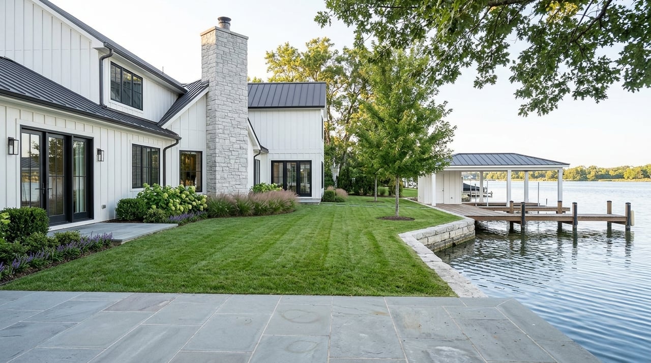
- Privacy and views: Coves often feel more private, with tree-lined banks and narrower sightlines. At low water, you may see exposed natural foreshore. Main-channel lots deliver wider, panoramic views alongside more activity and sound.
- Access and services: Marinas and public ramps tend to be on or near the main channel. Cove locations rely more on private docks and sometimes longer transits to fuel or service.
If calm water and family swim time are your top priorities, a sheltered cove with a floating dock is a strong match. If you want broad views and keep a deeper-draft cruiser, the main channel or a deep cove is usually the better choice.
Hazards that change with levels
As levels drop, underwater features rise closer to the surface. Be mindful of:
- Exposed stumps, submerged logs, and sandbars in coves.
- Narrower approach channels near docks during low water.
- Shifting sediment that can make buoys or informal channels less reliable.
- Turbid water after storms, which can hide hazards even at higher levels.
Follow local navigation best practices and safe speeds near shore. For inland boating rules and safety guidance, review the North Carolina Wildlife Resources Commission’s boating information.
How levels affect views and shoreline
Water level changes do more than impact boating. They also shape what you see from your deck and how your bank holds up over time.
- Wider water at higher levels can extend the visual reach of your view and make swimming access easier.
- Lower water can expose roots, mud, and natural foreshore, which some buyers find less appealing. In deciduous areas, winter leaf-off can open views while the lowered water reveals more shoreline.
- Repeated water movement and wake energy put stress on banks. Seawalls, riprap, and vegetative buffers are common ways to stabilize shorelines. On exposed main-channel lots, erosion control is especially important.
Before you buy, look for evidence of prior shoreline work and ask about ongoing maintenance.
What to look for on a tour
Bring this quick checklist when you walk a 28037 waterfront property:
- Ask for documented high and low lake levels that affected that parcel and any recent operating notices from Duke Energy.
- Measure or obtain depth at the dock and along the approach path to your slip.
- Identify the dock type, gangway length, and lift configuration. Note condition of pilings and hardware.
- Map the home’s position to the main channel and navigation buoys. Note distance to marinas.
- Scan for exposed debris, stumps, or shoals at current levels.
- Confirm the permitting history for the dock and any boathouse. Ask about HOA rules for dock types and the number of watercraft.
- Consider the slope from the house to the dock and whether a longer gangway would be needed at lower water.
These details affect both daily enjoyment and resale value.
Smart ownership habits
Once you own on the lake, planning and regular checks make life easier:
- Monitor levels using Duke Energy’s lake resources and review any drawdown or advisory notices.
- After major storms, inspect docks, lifts, and moorings for damage. Check for turbid water and submerged debris before heading out.
- Review insurance coverage for docks and boats. Carriers may ask about historical high-water or storm-related damage.
- Budget for long-term items that some coves require, such as lift upgrades, dock reconfiguration, or potential dredging if sedimentation is recurring.
Match location to your lifestyle
Choosing between a cove and the main channel comes down to how you live on the water. If you want quiet swimming and privacy, a sheltered cove with a floating dock can be ideal, with the understanding that winter or low water might change the shoreline’s look and access. If you prize wide views and keep a deeper-draft cruiser, prioritize the main channel or a deep cove with documented minimum depths and robust dock engineering.
Make sure any decision is grounded in local facts. Verify current lake conditions and review county permitting early. Your future self will thank you when your boat launches easily in January and your dock stays usable in August.
Ready to evaluate 28037 waterfront
If you are weighing a purchase or considering a sale in the 28037 stretch of Lake Norman, expert guidance makes all the difference. From reading Duke notices to verifying dock depths and navigating permits, you deserve a partner who knows the water as well as the market. For confidential advice and a tailored plan for your goals, connect with Liz Miller.
FAQs
Who controls Lake Norman’s water level?
- Duke Energy manages Lake Norman for hydroelectric generation and system-wide water needs, which is why levels change with power demand, flood control, maintenance, and weather.
How do seasonal levels affect 28037 docks?
- Winter and fall drawdowns can make small Lincoln County coves shallower and expose foreshore, while summer is usually closer to recreational targets with occasional short-term fluctuations.
Is a floating or fixed dock better in coves?
- Floating docks adapt to changing water and are often best for coves, provided the gangway is long enough and shore attachments are engineered for seasonal swings.
Can I keep a large cruiser in a cove year-round?
- It depends on documented minimum depths along your approach; deeper-draft boats usually do better on the main channel or in a deep cove with proven depth.
Who permits new docks on Lake Norman?
- Duke Energy’s shoreline program sets lake-wide rules, and Lincoln County handles local zoning and building permits for docks and shoreline work.
How do levels change my view and shoreline?
- Higher water can broaden sightlines and ease swimming access, while lower water may reveal natural foreshore and increase the need for erosion control on exposed banks.
Where can I check today’s lake level?
- Use Duke Energy’s lake resources for operating notices and real-time updates, and the USGS site for regional water data when you need an additional reference.